
Rural parish · Cuenca, Ecuador
Checa, Cuenca
Discover Checa, a rural parish of Cuenca, with its local history, communities, landscape and practical map context.
Village plaza & mountain waters
Explore Checa
Find the plaza, mountain lookouts and the reservoirs above the parish. Numbers on the map match the list.
Explore the places below.
6 places
- 1Plaza de ChecaVisit
Start at the plaza beside Checa’s parish church.
- 2Iglesia de San Andrés de ChecaVisit
The parish church honours San Andrés in the centre of Checa.
- 3Camino al CieloOutdoors
A mountain lookout above Checa’s rural communities.
- 4ZhingllaVisit
A rural community in Checa’s hills.
- 5Embalse de ChanludOutdoors
A reservoir among the northern mountains of the Machángara basin.
- 6Embalse El LabradoOutdoors
A mountain reservoir shared by the highlands of Checa and Chiquintad.
Imagery: Cuenca · ESA · Copernicus. © OpenStreetMap contributors. Map sources
Jidcay, Checa and San Andrés
The parish's official history records two explanations for the name Checa: a memory of the Cañari leader Chica-Cápac and a later association with Archbishop Ignacio Checa y Barba. The same account describes San Andrés as the patron and names processions, village bands, fireworks, dances and community gatherings in the annual religious life. 1 3
The Machángara and the highland reservoirs
The Machángara runs between Checa and Chiquintad. In the high country, Chanlud and El Labrado store water for the hydroelectric system. Along the Chulco, a landslide once blocked the river and formed a lake. The old stonework at Zhinglia offers another glimpse into the history of this landscape. 2 3
PDFs and documents
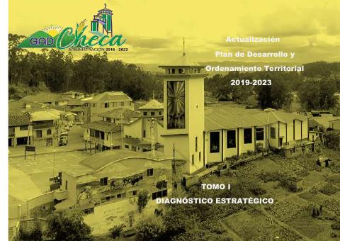
PDF · 3
Actualización del PDOT de Checa 2019–2023. Tomo I, diagnóstico
GAD Parroquial de Checa · 2020 · 331 pages
The earlier parish diagnosis covers the Chulco, Machángara and reservoirs (PDF pp. 245–248), with community celebrations and customs on pp. 267–268.
Open document
Government and further reading
Official source · 1
Datos Generales
GAD Parroquial de Checa
Official history of Checa/Jidcay, its foundation, name traditions, San Andrés festivities and neighboring parishes.
Visit sourceOfficial source · 2
Ubicación Geográfica
GAD Parroquial de Checa
Official location profile with Checa's northern Cuenca setting, boundaries and principal rivers.
Visit sourceOfficial source · 4
Rural Tourist Route: Sinincay – Chiquintad – Checa
Fundación Municipal Turismo para Cuenca / VisitCuenca · 2024
Municipal tourism route page presenting Cabañas Torres in Checa and nature-based activities in the rural circuit.
Visit sourceOfficial source · 5
Publicación dedicada a la parroquia Checa
Red de Bibliotecas Municipales de Cuenca
Municipal library catalog record for a Checa publication featuring natural beauty, social life and Cañari archaeological traces at Shinglia.
Visit source
Walks through this parish
- Cerro Zhinglla - cerro Cachaulo · CaminANTES Route 1
Something changed?
A stop moved, a line changed or a place closed? Tell us and we will check it.
Report a problem