
BEYOND CUENCA
Cajas
A day among lakes, páramo and Andean woodland.
Start with a place you want to see. Plan how to reach it, leave time for the return, and let the weather set the pace.
01 · THE JOURNEY
Getting there from Cuenca
By bus
At Cuenca’s Terminal Terrestre, ask for a bus toward Guayaquil that travels via Cajas, on the Cuenca–Molleturo–Puerto Inca road. Confirm that it stops at Toreadora or at the Llaviucu access, depending on your plan. 1
Before paying, confirm the departure, current fare, exact drop-off and where to catch the return bus. A stop on the main road may still leave an approach walk; ask about the distance to the visitor entrance.
By car or with a driver
Head west from Cuenca along the road through Sayausí toward Molleturo and Puerto Inca. Llaviucu has a separate access; Toreadora is farther along the main road. Agree on the destination, pickup point and return time if hiring a driver. 1
Check road conditions and the forecast before leaving, and ask the park about access to the area you want to visit.
02 · YOUR FIRST STOP
Choose the landscape
Toreadora
For the open highland landscape: lake, páramo and surrounding ridges. Start at the visitor control and ask which marked walk suits the day’s conditions. ETAPA lists the Toreadora trail at about 2.8 km and two hours; altitude and weather still matter. 5
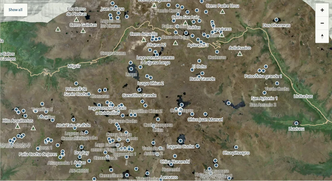
Find Toreadora on the map →Llaviucu
For Andean woodland, a glacial valley and birdwatching around the lake. At roughly 3,160 m, this is lower than the Toreadora area, but still at altitude. Confirm the approach to the Llaviucu control and the available walks with park staff. 6 4
Find Llaviucu on the map →
For a summit or a longer crossing, choose a route with the park or an authorized guide. Authorized operators
03 · BEFORE LEAVING
Register and pack for the day
ETAPA’s visitor guidance directs the general public to reserve before entry and register at a designated control. Bring identification, check the current arrangements for your chosen area and confirm your route with the ranger on arrival. 2
- Warm layers, waterproof outerwear, gloves and walking shoes with grip.
- Water, food, sun protection and a hat.
- Identification, a charged phone and a map you can consult without a connection. Tell someone your plan and expected return.
ETAPA’s packing and visitor recommendations 3
04 · ON THE GROUND
Take the altitude and weather seriously
Allow time to acclimatize
Take it slowly, especially after arriving from lower elevations. If you develop headache, nausea or dizziness, stop ascending. Descend if symptoms worsen despite rest; confusion, loss of coordination or breathlessness at rest need urgent medical help. 7 8
Keep the walk within the day
Cold, rain and thick fog can change a walk quickly. Follow ranger advice, stay on marked paths and turn back when conditions deteriorate. ETAPA advises against starting or continuing walks after 16:00. 3
Keep fires out of the park, leave plants and wildlife undisturbed, carry your rubbish out and stay out of the lakes. 3
Emergency: 911. Give your location, the nearest named landmark and what happened. 9
Sources and update notes
Last reviewed 11 September 2026. Check access, reservations, transport and weather before you travel.
- ETAPA · Accesos
- ETAPA · Registro y reservas
- ETAPA · Reglas y recomendaciones
- ETAPA · Información para visitantes
- ETAPA · Rutas y senderos
- ETAPA · Guía de aves (2012), valle de Llaviucu
- CDC · Travel to High Altitudes
- CDC Yellow Book · High-Altitude Travel and Altitude Illness
- ECU 911 · Atención de emergencias
- ETAPA · Operadores de turismo autorizado