
Cajas National Park · Walking route
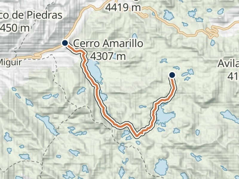
Cajas Route 8: Gran Osohuaycu
From the road at Luspa through the Osohuaycu area to Burines.
- Mapped distance
- 12.4 km
- Walking time
- 7 h 00ETAPA estimate for the full route
- Difficulty
- High
- Average altitude
- 3,946 m
The route
A long walk through the lake country south of Luspa. The mapped path finishes at the Burines junction with Routes 6 and 7; arrange your onward route and return before leaving.
Elevation profile
≈ 3,756–4,104 m- Total gain
- ≈ 630 m
- Total loss
- ≈ 490 m
In the direction shown below. Walking in reverse swaps gain and loss.
Approximate terrain elevation · Copernicus GLO-30
If returning along the same path
24.8 km · gain ≈ 1,130 m · loss ≈ 1,130 m
These totals include walking the highlighted path both ways. For a crossing, arrange onward travel from the end.
By car, allow time to get back to your parking place. By bus, plan your finishing stop and the last service before setting out.
Continue from Burines
Follow Route 6 from the junction to either road exit.
- Carretera · LuspaStart
- Laguna Luspa
- Sector Osohuaycu
- Cruce de BurinesEnd
Before you walk
- Register at the control
Ask which way the route is marked that day, and stay on it.
- Start early
No walk may start or continue after 16:00.
- Dress for cold and rain
Warm waterproof layers, good shoes, water and food. The weather changes fast at this altitude.
- Stay out of the lakes
Swimming and wading are not allowed.
Getting there: Start in the Luspa area. Plan your walk back or transport from the finish before setting out. Transport and registration
More Cajas routes
Something changed?
A stop moved, a line changed or a place closed? Tell us and we will check it.
Report a problem