
Cajas National Park · Walking route
Cajas Route 5: Avilahuaycu Summit
A steep climb from the Cucheros road to Avilahuaycu, with the return along the same path.
- Mapped distance
- 1.8 kmOne way; return along the same path
- Walking time
- 6 h 20ETAPA estimate for the full route
- Difficulty
- High
- Average altitude
- 4,006 m
The route
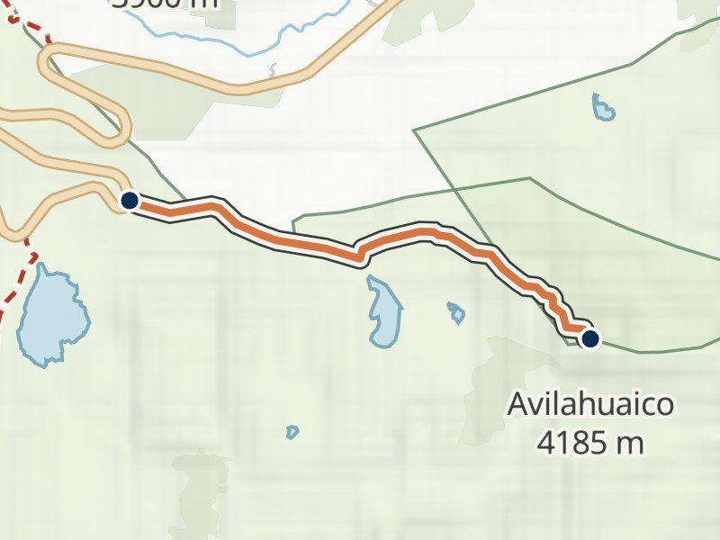
The map shows the uphill path. Allow for the descent along the same route when planning your outing.
Elevation profile
≈ 3,832–4,160 m- Total gain
- ≈ 340 m
- Total loss
- ≈ 10 m
In the direction shown below. Walking in reverse swaps gain and loss.
Approximate terrain elevation · Copernicus GLO-30
Out and back
3.6 km · gain ≈ 340 m · loss ≈ 340 m
These totals include walking the highlighted path both ways. For a crossing, arrange onward travel from the end.
By car, allow time to get back to your parking place. By bus, plan your finishing stop and the last service before setting out.
- Carretera · CucherosStart
- Cumbre del AvilahuaycuEnd
Before you walk
- Register at the control
Ask which way the route is marked that day, and stay on it.
- Start early
No walk may start or continue after 16:00.
- Dress for cold and rain
Warm waterproof layers, good shoes, water and food. The weather changes fast at this altitude.
- Stay out of the lakes
Swimming and wading are not allowed.
Getting there: Start in the Cucheros area. Allow time to return down the same path. Transport and registration
More Cajas routes
Something changed?
A stop moved, a line changed or a place closed? Tell us and we will check it.
Report a problem