
Rural parish · Cuenca, Ecuador
Molleturo, Cuenca
Explore Molleturo, Cuenca's large western parish, with its mountain communities, roads, history and changing landscapes.
Village life & mountain waters
Explore Molleturo
Discover the parish centre and the communities and lakes in the mountain landscape. Numbers on the map match the list.
Explore the places below.
6 places
- 1Centro de MolleturoVisit
The parish centre lies among the western mountain slopes.
- 2Iglesia de MolleturoVisit
The parish church stands beside Molleturo’s central plaza.
- 3San Pedro de YumateVisit
A rural community north of central Molleturo.
- 4San Felipe de SuruVisit
A community in the hills north of the parish centre.
- 5Mirador de las Playas EncantadasOutdoors
A lookout over the mountain waters of Cajas.
- 6Laguna SunincochaOutdoors
A lake in the high mountain landscape of eastern Molleturo.
Imagery: Cuenca · ESA · Copernicus. © OpenStreetMap contributors. Map sources
A parish crossed by the Qhapaq Ñan
Molleturo's territorial plan describes the Inka road as an older Cañari chaquiñán later improved as the Qhapaq Ñan, a route used for messages, exchange and movement across the Andes. Paredones, a Cañari–Inka archaeological site, is protected in a municipal reserve record and remains one of the parish's strongest links between heritage and landscape. 1 5 2
Water across three environments
The municipal tourism account groups Molleturo's identity around rivers, lagoons, cascades and hot springs. VisitCuenca's parish guide adds the high Tres Cruces landscape, the Migüir viewpoint and tarabita, the central church of San Santiago and San Felipe, and the Paredones route as distinct settings within one very large parish. 2 3 1
From trout country to cacao and sugarcane
Above the lowlands, Migüir is known for trout. The producers and cooks who took part in its 2026 Trout Festival show how that food tradition supports local work. In the lower southern communities, cacao and sugarcane tell a different farming story, with mills that press cane for its juice. 1 6
Videos

YouTube · 7
Video de bienvenida a la parroquia Molleturo (1)
GAD Parroquial de Molleturo
Parish introduction embedded on the official Molleturo GAD welcome page.
Watch on YouTube
YouTube · 8
Video de bienvenida a la parroquia Molleturo (2)
GAD Parroquial de Molleturo
Second parish video embedded on the official Molleturo GAD welcome page.
Watch on YouTube
PDFs and documents
PDF · 1
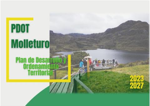
Plan de Desarrollo y Ordenamiento Territorial de Molleturo 2023–2027
GAD Parroquial de Molleturo · 2024 · 621 pages
The 2024 update describes architectural heritage on PDF pp. 391–398. Its tourism inventory separates the highlands and the lower north and south on pp. 431–436.
Open document
Government and further reading
Official source · 2
Molleturo parroquia del agua
GAD Municipal de Cuenca
Municipal identity proposal centered on Molleturo's rivers, lagoons, cascades, hot springs, Qhapaq Ñan and Paredones.
Visit sourceWebsite · 3
Molleturo: La parroquia del Agua
Fundación Municipal Turismo para Cuenca / VisitCuenca · 2023-08-23
Tourism guide to Tres Cruces, Migüir, the tarabita, the central church, Paredones and trout-based local food.
Visit sourceWebsite · 4
Plan de desarrollo turístico para la parroquia Molleturo del cantón Cuenca, provincia del Azuay 2019-2023
Universidad de Cuenca · 2019-09-04
University tourism plan describing Molleturo's scale, three climatic zones, agricultural diversity and tourism potential.
Visit sourceOfficial source · 5
Declaratoria de utilidad pública con ocupación inmediata del sitio arqueológico “Paredones de Molleturo”
GAD Municipal de Cuenca · 2000-03-15
Municipal resolution recording Paredones as an archaeological reserve site in the western cordillera.
Visit sourceOfficial source · 6
Migüir celebró el VII Festival de la Trucha y fortaleció el turismo rural de Cuenca
GAD Municipal de Cuenca · 2026-09-02
Municipal report on the 2026 Migüir Trout Festival and its links to producers, gastronomy, tourism and local enterprise.
Visit source
Something changed?
A stop moved, a line changed or a place closed? Tell us and we will check it.
Report a problem