
Rural parish · Cuenca, Ecuador
Sinincay, Cuenca
Explore Sinincay, Cuenca, through its rural communities, working landscape, history and bus-linked map context.
Parish plaza, waterfall & stone
Explore Sinincay
Find the parish centre and discover the waterfall and rocky landscape nearby. Numbers on the map match the list.
Explore the places below.
6 places
- 1Parque Central de SinincayVisit
The central park stands beside Sinincay’s parish church.
- 2Iglesia de San Francisco de SinincayVisit
The parish church reflects Sinincay’s traditional building materials.
- 3Cascada de CaboganaOutdoors
A waterfall on the wooded hillside west of Sinincay.
- 4El SaladoOutdoors
A community known for its natural stone formations.
- 5Gruta de la Virgen de la NubeVisit
A roadside grotto in the Cruz Calle neighbourhood.
- 6San Luis de Las LajasVisit
A community church in the countryside north of Sinincay.
Imagery: Cuenca · ESA · Copernicus. © OpenStreetMap contributors. Map sources
Material culture and inherited trades
The parish government identifies brickmakers, sculptors, marble workers and toquilla-straw hat weavers as part of Sinincay's inherited craft identity. It also describes San Francisco de Sinincay church, completed in 1936 after 27 years of work, and notes the use of tile, adobe, bahareque, cane and local marble in the built landscape. 1 2 7
Vivencial tourism and nature
The municipal route links Sinincay with Chiquintad and Checa and describes a historical-cultural walk, agroecological activities, artisan work and a route toward the San Antonio waterfall. The parish tourism page adds Cabogana waterfalls, hills, páramo, birdwatching and the El Sol Saliente viewpoint. These pages are descriptive leads; practical conditions need checking with the parish or operator. 4 2 5
Festivals and a working landscape
Sinincay's municipal identity is tourism vivencial, and the 2024 route launch explicitly connected the parish's plaza, entrepreneurs, artisans and agroecological activity. A 2025 video follows an apiary experience in Sinincay, showing how contemporary rural tourism can grow from a working landscape rather than a single monument. 4 6 5
Videos

YouTube · 5
Cuenca rural: Apicultura en la parroquia de Sinincay
Luis Velásquez Pazmiño · 2025-05-27
2025 video visit to Casa Matilde Apiario and a local beekeeping experience in Sinincay.
Watch on YouTube
PDFs and documents
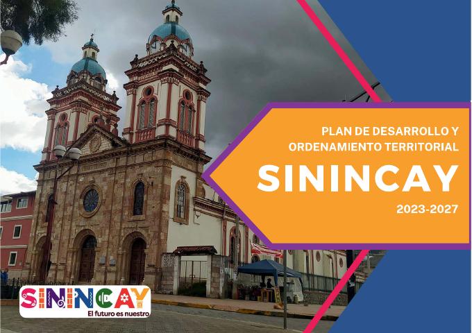
PDF · 3
Plan de Desarrollo y Ordenamiento Territorial Sinincay 2023–2027
GAD Parroquial de Sinincay
Current parish planning PDF with heritage, economic, environmental and territorial sections.
Open document
Government and further reading
Official source · 1
Datos Generales
GAD Parroquial de Sinincay
Official parish profile describing location and inherited craft and production work.
Visit sourceOfficial source · 2
Sitios Turísticos
GAD Parroquial de Sinincay
Official list and descriptions of San Francisco church, Cabogana waterfalls, hills, páramo, birdwatching and El Sol Saliente viewpoint.
Visit sourceOfficial source · 4
Alcalde inaugura la ruta turística rural Sinincay, Chiquintad y Checa
GAD Municipal de Cuenca · 2024-07-01
Municipal account of the 2024 rural route and its historical, agroecological, artisan and waterfall components.
Visit sourceOfficial source · 6
Sinincay parroquia del turismo vivencial
GAD Municipal de Cuenca
Municipal proposal connecting Sinincay's brick, tile and marble production to living tourism.
Visit sourceWebsite · 7
Sinincay ayer y hoy: número 1
Ministerio de Educación del Ecuador / Red de Bibliotecas Municipales · 1998
Municipal catalog record for the 1998 illustrated parish history, including church, crafts, festivities, legends and community life.
Visit source
Something changed?
A stop moved, a line changed or a place closed? Tell us and we will check it.
Report a problem