
CAMINANTES · WALKING ROUTE 10
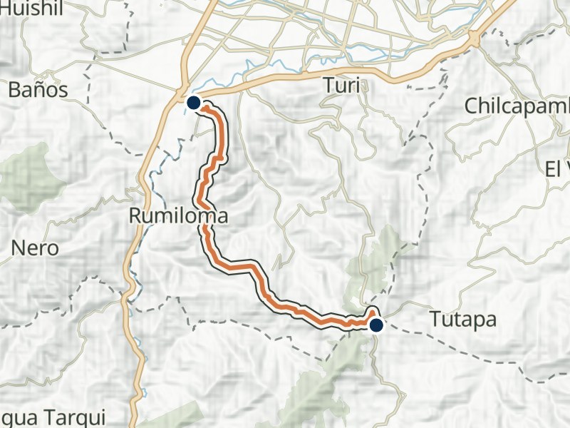
Jutcoloma - Papaloma
- Distance
- 8.42 km
- Walking time
- 4 h
- Difficulty
- Low
Explore the route
Elevation profile
≈ 2,567–2,899 m- Total gain
- ≈ 240 m
- Total loss
- ≈ 570 m
In your walking direction, from start to finish.
Approximate terrain elevation · Copernicus GLO-30
The full map adds 3D terrain and satellite imagery. Save the GPX to your walking app before setting out.
Getting there and back by bus
Near the start · closest bus service
- Entrada Parcoloma1.8 km from the start
Line 21 towards Feria Libre
- Falla Geológica2 km from the start
Line 21 towards El Verde
Near the finish
- Entrada Carmen de Guzho110 m from the finish
Line 17 towards GuzhoLine 13B towards Hospital del IESSLine 17 towards Yanaturo
- Entrada a 5 Esquinas110 m from the finish
Line 4 towards Campus BalzayLine 4 towards Narancay
More nearby stops (7)
- Entrada a la Autopista300 m from the finish
Line 13B towards Mall del Río
- Control Sur320 m from the finish
Line 13B towards Hospital del IESSLine 17 towards YanaturoLine 18 towards UPSLine 21 towards Feria LibreLine 13B towards Mall del RíoLine 17 towards GuzhoLine 18 towards ZhucayLine 21 towards El Verde
- Américas y 2 de Agosto360 m from the finish
Line 5 towards Borja
- Av. Loja y Av. de las Américas370 m from the finish
Line 12 towards Quinta ChicaLine 17 towards YanaturoLine 5 towards Totoracocha
- Av. Loja y Av. Américas440 m from the finish
Line 12 towards BañosLine 17 towards Guzho
- Ricardo Durán y Pedro V Maldonado470 m from the finish
Line 100 towards BañosLine 12 towards BañosLine 5 towards Borja
- Ricardo Durán y Pedro Vicente Maldonado490 m from the finish
Line 100 towards RicaurteLine 12 towards Quinta ChicaLine 5 towards Totoracocha
Something changed?
A stop moved, a line changed or a place closed? Tell us and we will check it.
Report a problem