
CAMINANTES · WALKING ROUTE 3
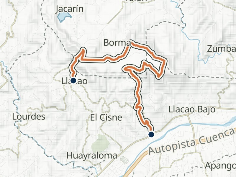
Llacao – Cerro Pachamama – Zhiquir
- Distance
- 11.8 km
- Walking time
- 4 h 30 min
- Difficulty
- Moderate
Explore the route
Elevation profile
≈ 2,394–2,787 m- Total gain
- ≈ 220 m
- Total loss
- ≈ 470 m
In your walking direction, from start to finish.
2,800 m2,350 m
0 km4.5 km9.0 km
Approximate terrain elevation · Copernicus GLO-30
The full map adds 3D terrain and satellite imagery. Save the GPX to your walking app before setting out.
Getting there and back by bus
Near the start
- La Y Entrada Santa María y Llacao220 m from the start
Line 31 towards Santa María · LlacaoLine 31 towards Centro
Near the finish
- Panamericana Norte10 m from the finish
Line 28 towards Feria Libre
- Entrada a Zhiquir10 m from the finish
Line 28 towards Guangarcucho
Something changed?
A stop moved, a line changed or a place closed? Tell us and we will check it.
Report a problem