
CAMINANTES · WALKING ROUTE 7
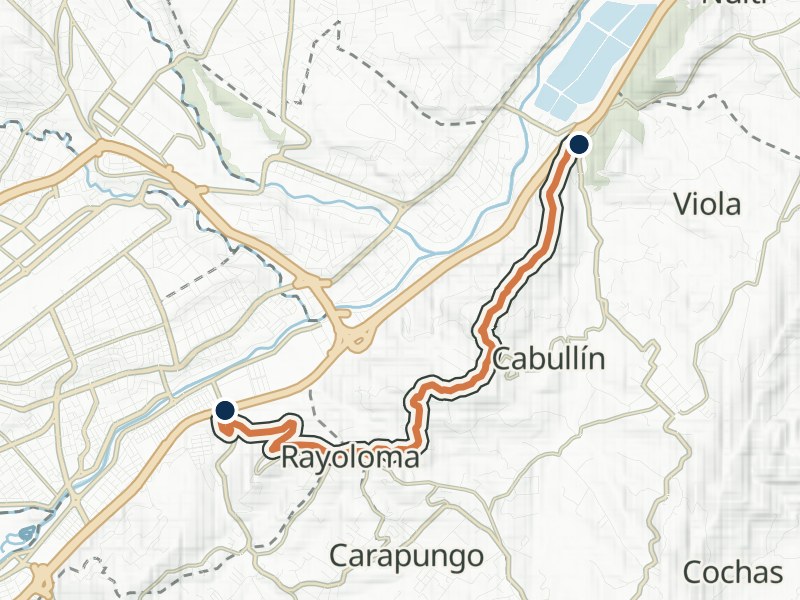
Ucubamba – Cerro Cabullín - Rayoloma
- Distance
- 6.32 km
- Walking time
- 3 h
- Difficulty
- Moderate
Explore the route
Elevation profile
≈ 2,446–2,687 m- Total gain
- ≈ 300 m
- Total loss
- ≈ 280 m
In your walking direction, from start to finish.
Approximate terrain elevation · Copernicus GLO-30
The full map adds 3D terrain and satellite imagery. Save the GPX to your walking app before setting out.
Getting there and back by bus
Near the start
- Polígono de Tiro20 m from the start
Line 29 towards PacchaLine 29 towards Centro
- Redondel de la Autopista100 m from the start
Line 34 towards NultiLine 34 towards Centro
Near the finish
- Puerto Principe, 3970 m from the finish
Line 4 towards Campus BalzayLine 4 towards Narancay
- Hospital del IESS160 m from the finish
Line 15 towards BaguanchiLine 23 towards RayolomaLine 15 towards Feria LibreLine 23 towards CentroLine 13 towards Racar · El TejarLine 13B towards Mall del RíoLine 16 towards RacarLine 13 towards Hospital del IESSLine 13B towards Hospital del IESSLine 16 towards Hospital del RíoLine 50 towards Hospital del RíoLine 50 towards San José de Balzay
More nearby stops (2)
- Urbanización Río Sol560 m from the finish
Line 1 towards KennedyLine 3 towards Kennedy
- Los Andes570 m from the finish
Line 1 towards Lirio
Something changed?
A stop moved, a line changed or a place closed? Tell us and we will check it.
Report a problem